There are over 369 miles of trails that meander along the Blue Ridge Parkway, providing a close-up view of some of the most beautiful wilderness in the country. Below is a complete list by Milepost, including length and difficulty. The Appalachian Trail and Mountains-to-Sea Trail are two long-distance trails that follow closely with stretches of the Parkway. Hikers may hike these trails for days, weeks, or even months at a time. Groups such as High Country Hikers or the Carolina Mountain Club have regular hikes that are open to the public, and many state parks and wilderness areas have ranger-led hikes. Information about hiking opportunities in your area can be found at your local visitor center or ranger station.
Parkway Trails

Explore the Parkway lands with this complete list of hiking trails by milepost, length, and difficulty.
Trail Safety

Learn how to keep yourself safe on the trail. Hiking in the mountains has a unique set of safety requirements.
Leave No Trace

Follow these seven principles to make sure your visit has a low impact on the wilderness areas you are exploring.
Appalachian Trail
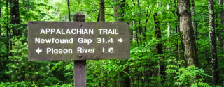
Use this list of Appalachian Trail crossings to explore the national scenic trail as it parallels the Parkway.
Blue Ridge Mountain Hiking Books & Maps
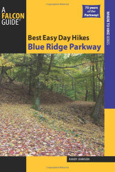
Spanning the border between Virginia and North Carolina, the Blue Ridge Parkway is the most heavily visited unit of the National Park system. These short, easy hikes will entice the more than twenty million annual visitors to stretch their legs and hit the trail. At-a-glance information and maps will help readers determine which hikes are the best for them.
Book Details Buy Now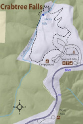
These three maps are an invaluable resource for anyone wanting to drive along the entire Blue Ridge Parkway. Together, the maps cover every section of the Parkway from where it begins at milepost 0 to its end at milepost 469.
Map Details Buy Now
Great Waterfalls of North Carolina is an informative guidebook for locating and photographing 65 waterfalls and cascades in the beautiful Blue Ridge and Great Smoky mountains of North Carolina.
Book Details Buy Now
This comprehensive guidebook provides a detailed description of every official trail along the Blue Ridge Parkway. But that’s just the beginning
Book Details Buy Now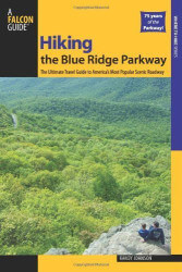
Hiking the Blue Ridge Parkway, just released in a newly revised and updated second edition for 2010, is an indispensable resource for anyone who uses the Parkway as a portal to the Southern Appalachian experience.
Book Details Buy Now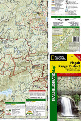
Each Trails Illustrated map contains detailed topographic information, clearly marked trails, recreational points of interest, and navigational aids. National Park series maps contain useful details for planning your visit. State series titles cover popular recreation areas, ideal for done-in-a-day activities.
Map Details Buy Now
The most comprehensive guide for the waterfalls of North Carolina. This edition includes over 600 waterfalls with detailed directions and ratings. There are over 100 color photographs and a special section about how to photograph waterfalls in general with specific hints for each individual waterfall. This is a must have for waterfall photographers.
Book Details Buy NowAdditional Blue Ridge Hiking Resources
Appalachian National Scenic Trail (U.S. National Park Service)
(http://www.nps.gov/appa/index.htm)
National Park Service website providing information on the Appalachian Trail.
High Country Hikers of Boone (Hiking Group)
(http://www.meetup.com/High-Country-Hikers/)
A hiking group formed to help coordinate group hikes in the High Country area of North Carolina, eastern Tennessee, and southwest Virginia.
HikeWNC.info's Hiking Guide to the Blue Ridge Parkway
(http://www.hikewnc.info/trailheads/blue-ridge-parkway/)
HikeWNC.info has an incredible amount of information on hiking in western North Carolina including a section dedicated to the trails they have reviewed along the Blue Ridge Parkway.
Kids in Parks' TRACK Trails
(http://kidsinparks.com/)
Kids in Parks is an expanding network of family-friendly outdoor adventures called TRACK Trails. Each TRACK Trail features self-guided brochures and signs that turn your visit into a fun and exciting outdoors experience.
Leave No Trace Center for Outdoor Ethics
(https://lnt.org/)
The member-driven Leave No Trace Center for Outdoor Ethics teaches people of all ages how to enjoy the outdoors responsibly, and is the most widely accepted outdoor ethics program used on public lands. - See more at: https://lnt.org/about#sthash.WlmxXV4W.
Trails.com - Blue Ridge Parkway
(https://www.trails.com/advancedfind.aspx?keyword=blue+ridge+parkway)
Use the Trails.com powerful search engine to find details on many trails along the Blue Ridge Parkway and share your experience with their community.