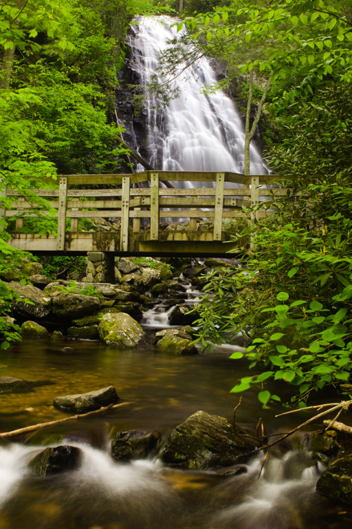
Crabtree Falls is a dramatic 70-foot waterfall at Milepost 339.5 on the Blue Ridge Parkway. It can be accessed via a 2.5-mile loop trail to a wooden bridge that crosses the river just below the falls. Just off the Parkway and before the trail begins, there is a campground and picnic area.
The Crabtree Falls area marks the last stretch of the Parkway through the Blue Ridge Mountains before it turns westward into the Blacks, Craggies, Pisgahs and Balsams near the Great Smoky Mountains National Park. The brilliant pink blossoms of the crabtree were once the cornerstone of this area’s wildflower display. Though there are hardly any crabtrees here now, the nearby meadows still become a showplace of wildflower in spring and early summer. Visitors can see hawthorne, beard tongue, mountain laurel, gentian, rosebay rhododendron, and many others.
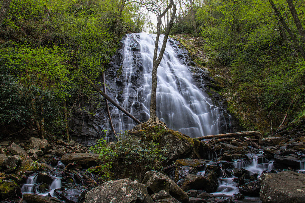
Photo by Ryan Watts at HD Carolina
Crabtree Falls Hiking Information
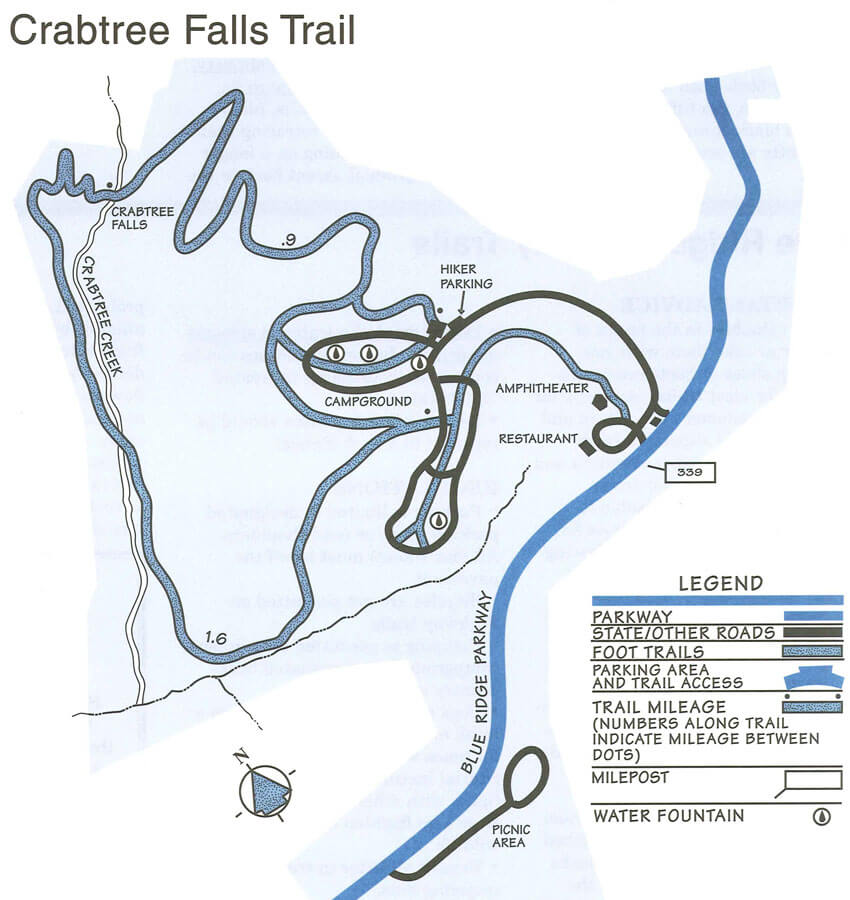 The scenic Crabtree Falls Loop Trail, a 2.5-mile loop trail to Crabtree Falls and back, is moderate to strenuous. Sturdy shoes or hiking boots are recommended because of the incline and rocky terrain. Hikers should allow 1.5 to 2.5 hours for the hike.
The trail descends a steep 0.9 miles to the falls through a mixes oak-hickory forest and thickets of rosebay rhododendron. From the falls, a hiker can either retrace his steps, or take the longer but more gradual ascent out of the valley.
Download the Crabtree Falls Trail map.
Crabtree Falls Campground Information
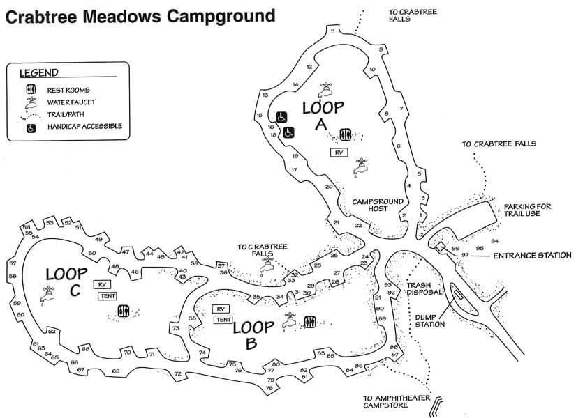 71 Tent Sites | 22 RV sites | 82 Picnic Sites
Other: Camping Supplies; Telephone
Crabtree Meadows is located at Milepost 339.5 within fifteen miles of Mt. Mitchell State Park. Crabtree Meadows campground usually opens in May.
Download the Crabtree Falls campground map.
Directions:
Crabtree Falls is located at Milepost 339.5 on the Blue Ridge Parkway about five miles south of Little Switzerland and about fifteen miles north of Mt. Mitchell.