North of Asheville, North Carolina, the Blue Ridge Parkway passes through the Great Craggy Mountains, an area of exposed rock surfaces and high peaks that provides breathtaking views of distant southern Appalachian ridges. Large expanses of native rhododendron cover the slopes and summits of the Craggies.

Photo by Justin Askew Photography
This area has long been known by local people as Craggy Gardens. June and July are the months to visit this spectacular showplace of pink and purple blooms of Catawba rhododendron cover the Craggies. Throughout the summer, smaller native wildflowers cover the ground with vibrant splashes of color. These natural gardens are “balds.”
Long after the blooms have been spent on the lower elevations, the violets, blackberry, May-apple, and Turkscap lily come into their own in this high-altitude portion of the Parkway. This heath bald is only one of many throughout the Southern Appalachian Mountains; the name refers to the bald appearance of the mountaintop, which is in reality covered with grasses or mountain shrubbery.
There is a visitor center, picnic area, and a variety of trails including the Craggy Pinnacle Trail, offering a panoramic view of the surrounding heath bald and rhododendron display.
A Unique Environment
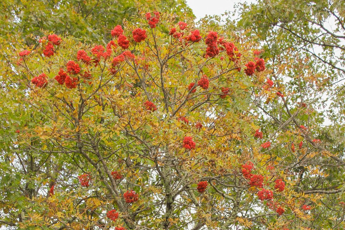
Mountain Ash Trees
Visitors come to see vistas, rocky crags, and the glorious display of wildflowers. In the fall, bouquets of bright red berries adorn the mountain ash and in early winter the Craggies’ twisted trees, often encased in ice, sparkle in brilliant sunshine. It is a lovely place. It is a unique environment.
The combination of high altitude, cool weather, and exposed rocky outcrops creates the necessary habitat for a number of rare and endangered plants. Many of these plants and their fragile habitats have been accidentally destroyed by people climbing on the rocks and will only be able to recover if the rocky outcroppings are left untouched. Please stay on the designated trails.
Craggy Gardens has been recognized by the state of North Carolina as a Natural Heritage Area and has also been recommended as a National Natural Landmark.
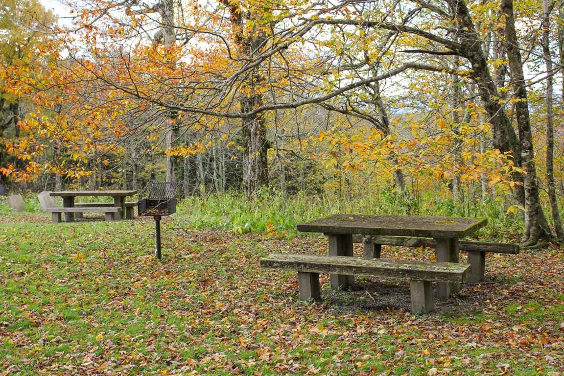
Craggy Gardens Picnic Area
What is a Bald?
A bald is a treeless area located on or near the summit of a predominantly forested mountain. Seen from a distance, the area appears bare. Closer inspection, however, reveals that balds are covered with low-growing vegetation – unique communities of plant life. Heath balds include rhododendron, mountain laurel, blueberries, and flame azalea. Grassy balds are made up primarily of grasses and wildflowers and, in some areas, they intermix with the heaths to form “pathways” through the rhododendron.
What caused the balds? No one knows for sure. Some may have resulted from natural causes such as fire or dramatic climate change over long periods of time. Other balds may be man-made, and some were probably cleared or enlarged by early settlers. We do know that many were used for pasturing livestock during summer months. In the Craggies, most grazing ceased in 1920, and all grazing was stopped in 1950 when the Blue Ridge Parkway acquired the land.
The Twisted Trees
A gnarled hardwood forest of beech, birch, buckeye, and mountain ash borders the Craggy balds. Because of the 5,500-foot elevation, weather conditions are severe. Strong winds, ice storms, and short growing seasons dwarf and stunt the trees. Lichens – the grey, crusty plants attached to the trunks and branches of most trees-cause no harm.
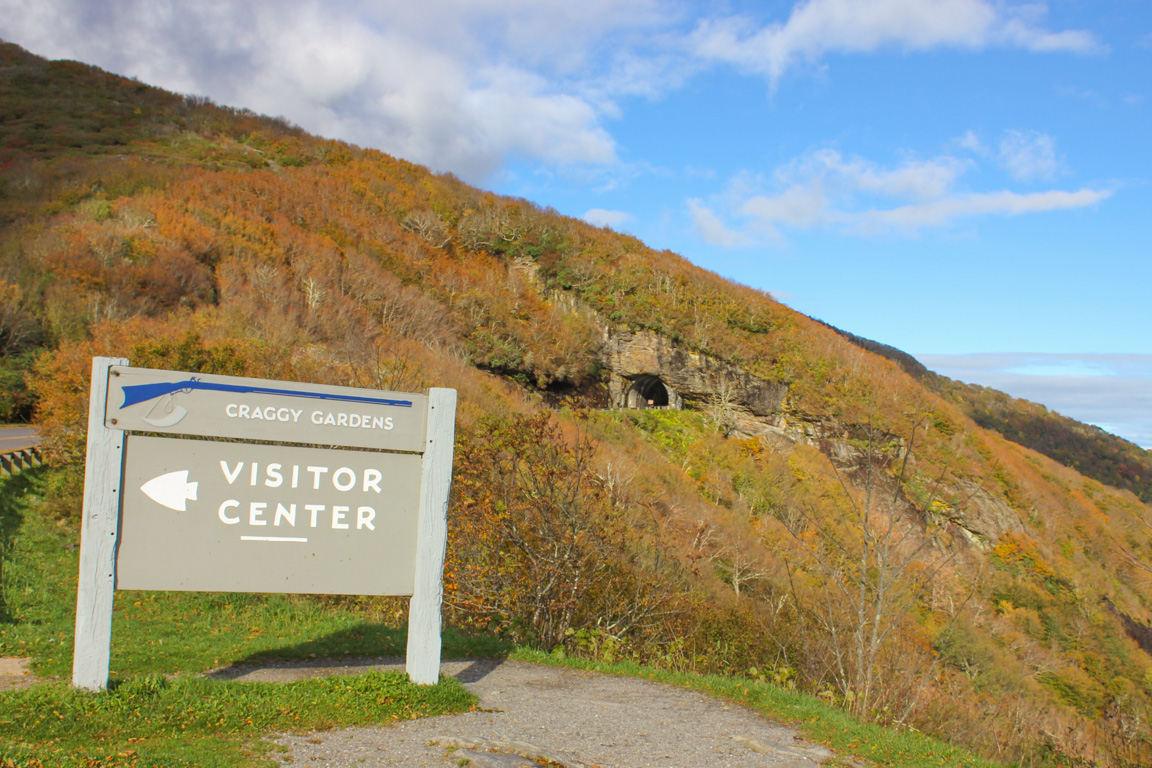
Craggy Gardens Visitor Center and Craggy Pinnacle Tunnel
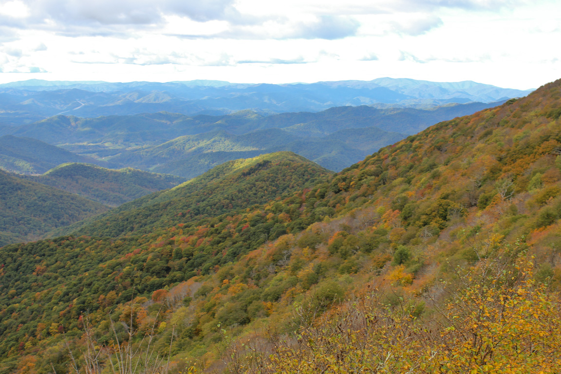
View from the Craggy Gardens Visitor Center
Craggy Gardens Hiking Information
 From high heath balds to mixed-hardwood forests, dense hemlock stands, and ridge-line paths, the Craggy Gardens area boasts a spectacular variety of scenery, terrain, and plant life. Its network of trails offers many opportunities to explore the features that make the Craggies special.
Download the Craggy Gardens trails map.
Craggy Gardens Trail
The Craggy Gardens Trail can be accessed from the south end of the Visitor Center Parking Area or from the north end of the Picnic Area. From the Parking Area, the trail begins as a self-guided nature trail with a moderate uphill climb for .3 mile to a large trail shelter. The self-guiding portion ends at the trail shelter, and a short spur trail to the left crosses the rhododendron bald to an unobstructed view of the town of Montreat and the lofty Black Mountain Range.
View from Craggy Pinnacle Trail, by Dawnfire Photography
The main trail descends gradually from the shelter to enter a mixed-hardwood forest and in another .5 mile reaches the Picnic Area. Half-way from the shelter to the Picnic Area a narrow loop path to the right leads to a small gazebo nestled in the forest and overlooking the valley below. Many wildflowers embellish the Craggy Gardens Trail from spring through fall, and blueberries on the bald offer an extra late-summer treat.
Douglas Falls Trails
Access to the Douglas Falls Trails (also known as the Carter Creek Falls Trails) is via the Mountains-to-Sea Trail. From Graybeard Mtn. Overlook, travel the MTS Trail south for one mile to the intersection with the falls trail. Follow the falls trail three miles through a mixed hardwood forest to its termination at the falls. The trail winds past a series of cascades and two virgin hemlock groves before reaching the 70-foot Douglas Creek Falls. This strenuous, but rewarding, 4-mile hike (8-mile round trip) has long been a favorite.
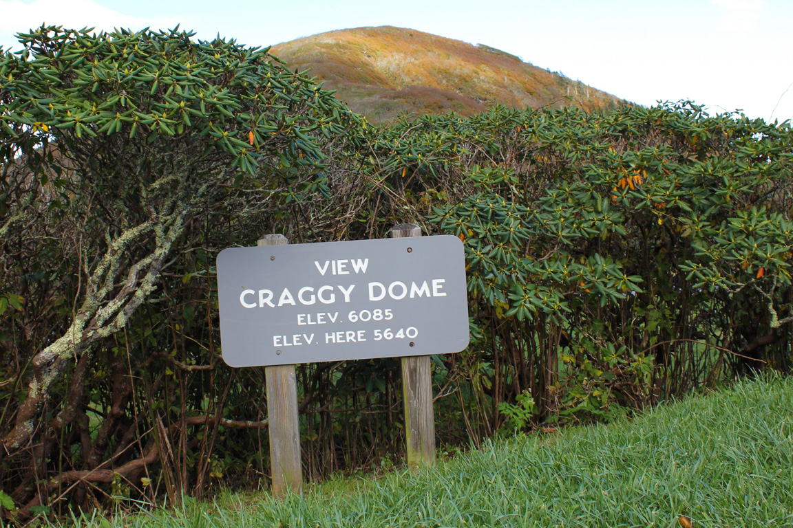
The Craggy Pinnacle Trail offers the most exceptional views for the least amount of walking. This moderate 20-minute walk begins from the upper level of the Craggy Dome Parking Overlook (just north of the tunnel that is in view from the Visitor Center). Visitors are rewarded with a breathtaking 360-degree view from its summit.
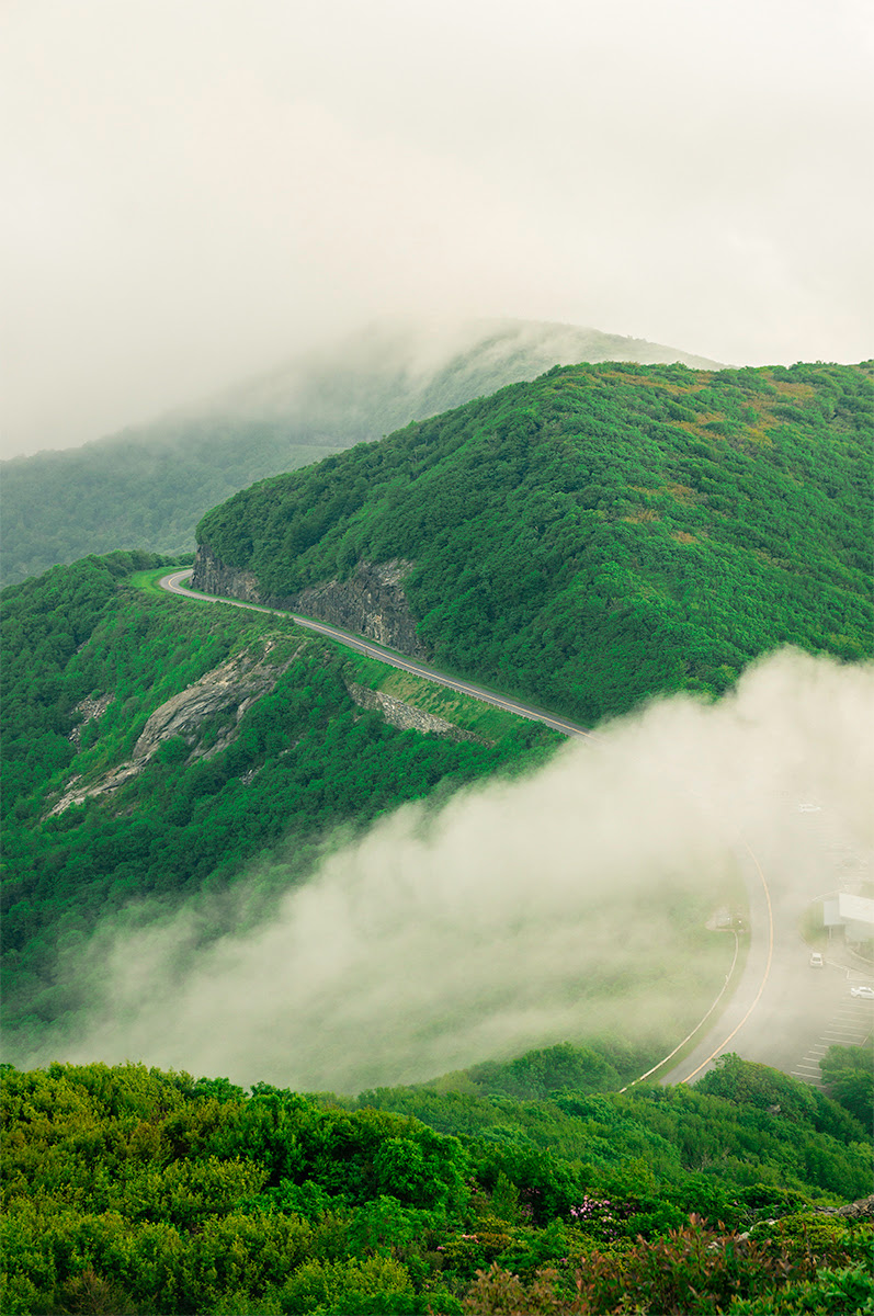
Craggy Dome Overlook, start of the Craggy Pinnacle Trail
Tunnels of rhododendron, gnarled sweet birch trees and wildflowers abound from the trail’s beginning to its crest. Here the heaths are mostly blueberries. A spur trail to the right, just before the summit, leads to an observation point surrounded by rugged, rocky terrain. Although stout in appearance, this is fragile habitat for many rare plants. To preserve the unique environment necessary for these plants’ survival, it is imperative to stay on the designated trails and off of the rocky outcrops.
Snowball Mountain Trail
The Snowball Mountain Trail is a moderate to strenuous 8-mile round trip and affords beautiful views. Beware of poison ivy and stinging nettle bordering narrow portions of the trail.
To reach the trailhead, start at the Mountains-to-Sea Trail crossing at the Picnic Area road and continue south a few hundred feet. The Snowball Trail turns to the right (NW) off of the MTS Trail, passes through a mixed-hardwood forest and follows the ridges with views to both sides. Some heath areas are encountered as the trail continues up the main ridge over Snowball Mountain. From the second rock face, and 30 paces on a spur trail to the left, Hawkbill Rock provides good views of Reems Creek Valley to the west. After joining a jeep road and reaching a turn-around area, keep to the left-most road and continue to Little Snowball Mountain and remnants of a fire tower.
Mountains-to-Sea Trail
The Mountains-to-Sea Trail skirts the southern side of Craggy Pinnacle and, when complete, will reach from the Smokies to the North Carolina coast. Accesses to the MTS Trail are located at the south end of the Visitor Center Parking area, at the north end of Craggy Gardens Picnic Area and at Graybeard Mt. Overlook, a mile north of the Visitor Center.